
GeoLocate
Data Entry and Edit Locality offer an inline georeferencing tool, GEOLocate. While very convenient, this tool is not magic; you, the user, are still responsible for the end result.
You must use an HTML5-compliant browser (that’s FireFox) to use this feature.
Higher Geography and Specific Locality are passed to GEOLocate. Trying to use the tool without these values won’t work properly.
After you click the GeoLocate button, an overlay containing an interactive map will open. This can be quite slow the first time you use it as data are cached. Check your cache settings if performance does not drastically increase for subsequent calls.
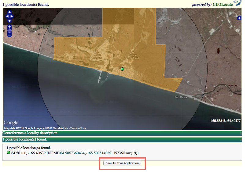
If the locality you passed in returns one result, simply check the georeference and click “Save to your Application” to accept the coordinates and error.
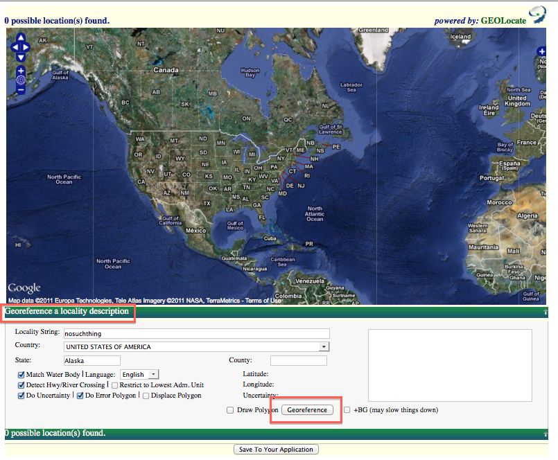
If the locality you passed in returns zero results, first check the higher geography and spec locality data. If it is accurate, you may edit the passed-in locality data by clicking “Georeference a locality description.” You may also use this pane to change default settings.
If the locality you passed in returns more than one results, you must click-to-select one of them before clicking “Save to your Application.” Check the results carefully – this can be confusing. The result with the green dot is “active.”
You may edit coordinates by dragging the green dot. You may edit uncertainty by clicking the green dot, following the link, and dragging the arrow that appears. You may zoom (on Mac) by holding SHIFT and dragging a rectangle with your mouse.
Edit this Documentation
If you see something that needs to be edited in this document, you can create an issue using the link under the search widget at the top left side of this page, or you can edit directly here.